

Case summary
On 8 March 2014, MH370 from Kuala Lumpur to Beijing disappeared from radar with 239 people aboard. Inmarsat satellite handshake data showed the aircraft turned toward the southern Indian Ocean; confirmed flaperon and wing debris later washed up on African shores. The main wreckage and cause remain unfound; the search resumed in 2025 on a no-find-no-fee basis.
Timeline
- 2014-03-08Last radio contact at 01:19; the transponder ceased and military radar tracked a turn west.
- 2014-03-24Inmarsat analysis announced: the flight ended in the southern corridor.
- 2015-07-29A flaperon found on Réunion was confirmed as belonging to MH370.
- 2017-01-17The first official underwater search (120,000 km²) ended without result.
- 2018-05-29Ocean Infinity's first search also ended empty-handed.
- 2025-02-25Ocean Infinity returned to the search zone under a new contract with Malaysia.
People and connections
- 9M-MRO (Boeing 777-200ER)
The registration of the missing aircraft.
- Inmarsat
The operator whose satellite handshakes defined the southern corridor.
- Ocean Infinity
The company running the 2018 and 2025 underwater searches.
- ATSB
The Australian agency that coordinated the 2015–2017 search.
- Inmarsat to 9M-MRO (Boeing 777-200ER)Hourly handshake (BTO/BFO) data defined the 7th arc
- ATSB to Ocean InfinitySearch boxes handed over, updated with drift models
Findings
That the flight ended in the southern Indian Ocean is documented by satellite data and confirmed debris.
The assessment that the transponder loss and turn reflect deliberate input was left at 'likelihood' level in the official report.
The official report and independent analyses diverge on the meaning of the pilot's simulator data.
Hijack-to-land, remote-takeover and third-country claims remain unevidenced.
Documents
- DocumentICAO Annex 13 final reportThe 1,500-page official investigation record, 2018.
- PhotographCatalogue of confirmed debrisThree 'confirmed' items including the Réunion flaperon, plus many 'likely' pieces.
- MapThe 7th arc and search boxesThe probable end-of-flight line derived from BTO/BFO calculations.
Sources
Locations
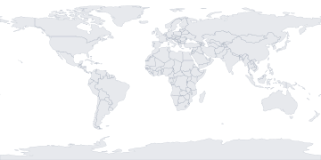
- 7th arc search zone-36.00°, 92.00°
- Kuala Lumpur (departure)2.75°, 101.71°
- Réunion (flaperon find)-21.11°, 55.54°
Researcher's note
Interpretation: MH370 is the boundary case of modern open-source research: it shows how indirect data like satellite handshakes becomes evidence through careful mathematics, and how, without physical wreckage, the narrative still stays open. Separating conspiracy claims from data-grounded uncertainty is the core discipline of this file.
Recent checks
- 2026-06-202025–26 search season status logged; no result announced.
- 2026-01-08Debris catalogue source refreshed.